 Kuang Si Falls Tours
Kuang Si Falls Interactive Map
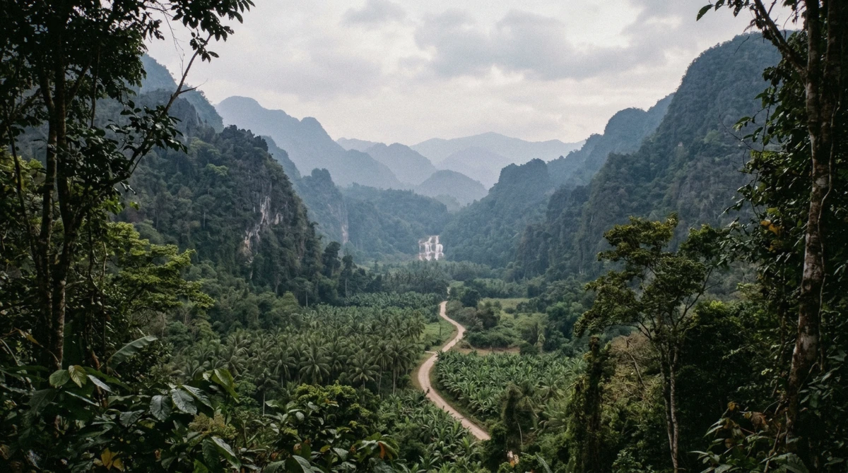
Most versions of a Kuang Si Falls map stop at a single pin on the waterfall. This one plots every stop the guided day trips actually make, from the ticket gate to the caves 25 km upriver, with the coordinates behind each pin and the tours that reach it. The full catalogue of guided trips to the falls sits on the homepage.
Quick answer
Kuang Si Falls sits at 19.7497, 101.9921, about 29 km south-west of Luang Prabang by road. The map below plots eleven stops the day trips visit, sized by how many tours reach each one, and the list under it prints the same data in plain text. Park entry is 60,000 kip and is covered on the fees page.
Key takeaways
- The swimming area is the lower pools, not the cascade itself, the rules are here
- Pak Ou Caves are 25 km upriver in the opposite direction, and only the $52 boat day reaches them
- Several stops on this map are reached by no tour we list, and the map says which
- The top of the falls has two routes: 542 paid steps, or the canal walk on the $43 hike
Every Stop on the Kuang Si Falls Day Trips, Mapped
Bubbles grow with the number of tours that stop there, so a small circle is information: it means the industry mostly skips it. Filter by anything, a place, a word in the description, or the name of a tour.
The same stops, in text
Coordinates are from OpenStreetMap. Where a stop has no published coordinates it is listed here without a pin rather than placed by guesswork.
-
Luang Prabang, where every tour starts
Every tourHotel pickup in the old town. The road to the falls is 29 km south-west and takes 40 to 50 minutes. The boat tours leave from the Mekong landing instead.
Stops here: Pak Ou day, $52, Canal hike, $43, Afternoon, $35
-
Ticket gate, car park and shuttle
Every tourWhere the road ends and the 60,000 kip ticket is bought in cash. An electric shuttle covers the last stretch to the park gate and is inside the ticket price.
Stops here: Pak Ou day, $52, Canal hike, $43, Afternoon, $35
-
Thapene village and the food stalls
Every tourThe strip of stalls and small restaurants outside the gate. Bottled water runs about 10,000 kip. Nobody will break a 500,000 note early in the morning.
Stops here: Pak Ou day, $52, Canal hike, $43, Afternoon, $35
-
Tat Kuang Si Bear Rescue Centre
Every tourFree the Bears keeps rescued Asiatic black bears in forested enclosures along the first stretch of path. Entry is inside the park ticket, with no separate fee.
Stops here: Pak Ou day, $52, Canal hike, $43, Afternoon, $35
-
The lower pools
Every tourThe stacked turquoise terraces the photographs are of, and the only part of the site where swimming is allowed. Changing huts sit beside the largest pool.
Stops here: Pak Ou day, $52, Canal hike, $43, Afternoon, $35
-
The main cascade
Every tourThe 60 m drop at the head of the pools, with a wooden footbridge across the outflow. No swimming under the cascade itself.
Stops here: Pak Ou day, $52, Canal hike, $43, Afternoon, $35
-
The top of the falls and The View
1 of the toursThe staircase on the near side of the bridge is 542 steps to The View cafe, paid separately at 30,000 kip and about an hour return. The canal route arrives at the top from behind instead, with no stairs and no extra fee.
Stops here: Canal hike, $43
-
Kuang Si Butterfly Park
No tourA small private garden 300 m before the gate, run by a Dutch couple since 2013, with its own ticket and its own hours: 11:00 to 16:00, closed Thursdays, shut through June and July.
No guided tour stops here. Self-drive only.
-
Ban Xang Hai, the whisky village
1 of the toursThe rice-whisky village on the Mekong, reached only by boat on the way to Pak Ou. It has no published coordinates in OpenStreetMap or Wikidata, so it carries no pin here.
Stops here: Pak Ou day, $52
-
Laos Buffalo Dairy
No tourA working dairy on the road out to the falls that sells buffalo cheese and ice cream and runs short farm tours. Every minivan passes the gate and none of them stops.
No guided tour stops here. Self-drive only.
-
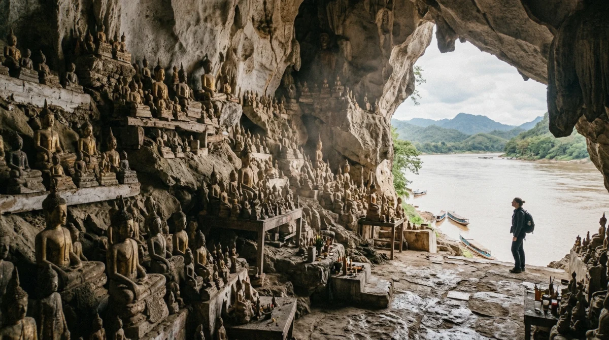
Pak Ou Caves
1 of the toursTwo river caves packed with thousands of Buddha images, 25 km upriver from town at the mouth of the Nam Ou. A different direction from the falls entirely.
Stops here: Pak Ou day, $52
-
Tad Sae Waterfall
No tourThe other waterfall near Luang Prabang, wider and lower than Kuang Si and reached by boat. It dries up outside the rainy months, which is why no tour here goes.
No guided tour stops here. Self-drive only.
How Far Each Stop Is From Luang Prabang
The falls and the caves lie in opposite directions from town, which is the single thing a map of this area has to make obvious.
Distances and the direction of travel
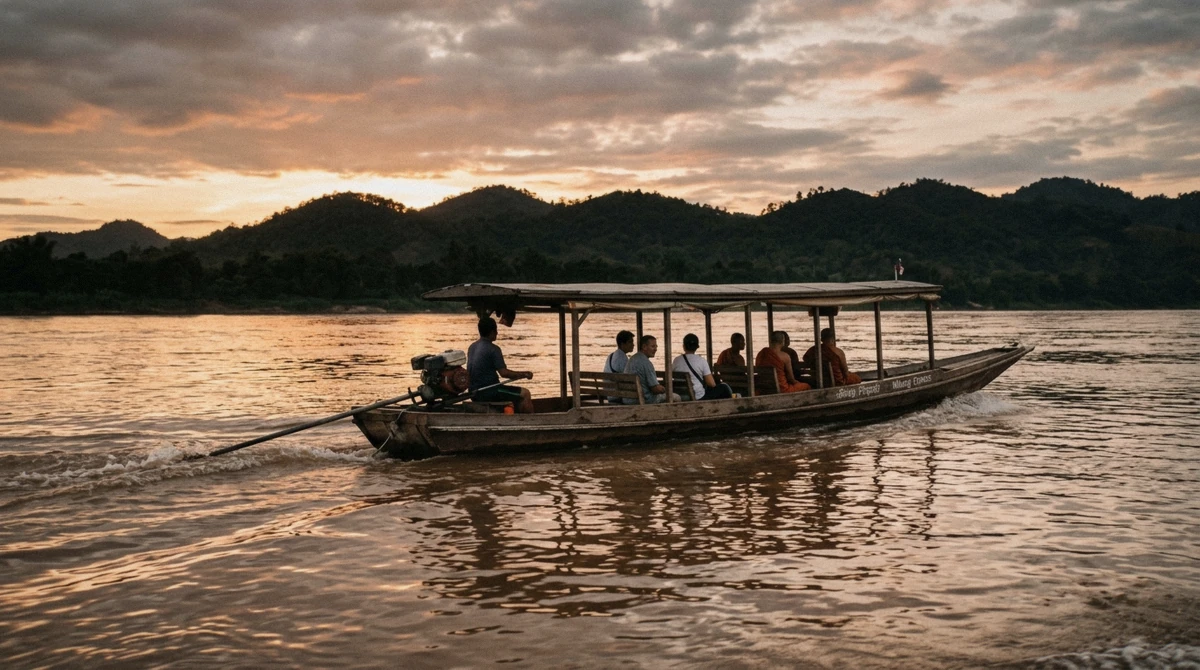
Kuang Si is south-west, up into the hills. Pak Ou is north-east, upriver. No tour reaches both by road in a sensible order, which is why the $52 day does the caves by boat in the morning and drives to the falls afterwards.
| Stop | Direction from town | Distance | How the tours get there |
|---|---|---|---|
| Kuang Si ticket gate | South-west | 29 km | Minivan, 40 to 50 minutes |
| The lower pools | South-west | 29 km | On foot from the gate, 10 minutes |
| Tat Kuang Si Bear Rescue Centre | South-west | 29 km | On the path from the gate |
| Kuang Si Butterfly Park | South-west | 29 km | Outside the gate, on your own |
| Ban Xang Hai | North-east | 20 km upriver | Long-tail boat, morning only |
| Pak Ou Caves | North-east | 25 km upriver | Long-tail boat, about 2 hours |
| Tad Sae Waterfall | East | 18 km, then a boat | Not on any tour we list |
Which Stops You Actually Need
If you have one afternoon and want the photograph
the lower pools and the main cascade are 300 metres apart and cover it. Everything else on this map is optional.
If you want the top of the falls without paying for stairs
the canal route on the $43 hike reaches it from behind, and the 542-step staircase becomes irrelevant.
If you are combining the falls with the river
the $52 Pak Ou day is the only one that reaches the caves and Ban Xang Hai, at the cost of ninety minutes at the water.
If you are travelling independently with a waiting driver
the Butterfly Park and the zipline open up, and both are absent from every tour itinerary here.
Which Tour Reaches Which Stop
The join below is read off the operator listings, not assumed. Where a column is empty, that tour does not go there.
The stop-by-tour grid
Every tour here covers the gate, the bear centre and the pools. The differences start above the pools and off the mountain entirely.
| Stop | Pak Ou day, $52 | Canal hike, $43 | Afternoon, $35 |
|---|---|---|---|
| Ticket gate and shuttle | Yes | Yes | Yes |
| Bear Rescue Centre | Yes | Yes | Yes |
| Lower pools | Yes, 2 hours | Yes, 3.5 hours | Yes, 2 hours |
| Main cascade | Yes | Yes | Yes |
| Top of the falls | No | Yes, by the canal | No |
| Ban Xang Hai | Yes | No | No |
| Pak Ou Caves | Yes | No | No |
| Mekong sunset cruise | No | Yes | Yes |
| Butterfly Park | No | No | No |
| Tad Sae Waterfall | No | No | No |
Reading the Map
Where the coordinates came from
Every pin on this map is an OpenStreetMap value, not a point dropped by eye. The in-park stops came out of an Overpass query around the park polygon, which is how the bear centre, the Butterfly Park, the shuttle stop and The View all resolved to their own nodes rather than sharing one generic waterfall pin. Pak Ou Caves and Tad Sae came from Nominatim. Where two sources disagreed we kept the one that matched the satellite imagery.
That matters more here than on a city map. Kuang Si is a linear site: the gate, the bears, the pools and the cascade sit in a line along one path, roughly 700 metres end to end, and a pin placed a few hundred metres off puts a visitor on the wrong side of the water with no bridge. The route from town is the easy part. The last ten minutes on foot is where people get turned around.
A small bubble is a finding, not a gap
The Butterfly Park sits five minutes from the car park and no tour stops there. Tad Sae only has water for part of the year, so the operators leave it alone. Both are on the map at their smallest size because knowing where the industry does not go is worth as much as knowing where it does.
One stop has no pin
Ban Xang Hai, the rice-whisky village on the Mekong, has an entry in Wikidata but no published coordinates, and no node in OpenStreetMap under any spelling. It is in the list without a pin. Placing it by eye somewhere along the river would look more complete and be less true.
The list is the page
Everything the map shows is printed underneath it in HTML, with the coordinates. If the map fails to load, or you are reading this through something that does not run JavaScript, nothing is lost.
What the map does not try to be
There is no elevation profile, no trail grading and no attempt to draw the paths themselves. The park maintains a single obvious route and the side paths are short. What the map adds over the pin you already have in your phone is the join: which of these stops a booked tour actually reaches, which is the one thing an operator listing will not lay out and a general guide cannot know.
Compare that against price and hours on the Kuang Si Falls tour comparison and the choice usually makes itself.
Kuang Si Falls Map: Questions Travellers Ask
What are the GPS coordinates of Kuang Si Falls?
19.7497, 101.9921 for the park itself. The main cascade sits at 19.74880, 101.99133 and the lower swimming pools at 19.74977, 101.99299. Those are OpenStreetMap values.
How far is Kuang Si Waterfall from Luang Prabang?
About 29 km south-west, 40 to 50 minutes by road. The transport options are compared here, from shared minivan to scooter.
Is Kuang Si Falls on Google Maps?
Yes, and the pin is accurate for the park entrance. What Google will not tell you is which stop a booked tour actually reaches, or that the Butterfly Park beside the car park is a separate business with a separate ticket. That is what the map above adds.
Where exactly can you swim?
In the lower pools, below the main cascade, not under the cascade itself, and not in the fenced upper pool. The full rules and the seasons are on the swimming page.
Why is Kuang Si Waterfall famous?
The colour. Limestone in the water leaves calcium carbonate on every lip and ledge, which builds the stacked terraces and turns the pools opaque turquoise in the dry months. Whether it lives up to it is a separate question.
Can I see Pak Ou Caves and the falls in one day?
Yes, but only in one direction and only by boat: upriver to the caves in the morning, then a road transfer to the falls. That is exactly what the $52 Pak Ou day does, and it leaves you two hours at the falls rather than three and a half.